
HIKING TO BEN LOMOND
July 2010 - 72 photos
July 2010 - 72 photos
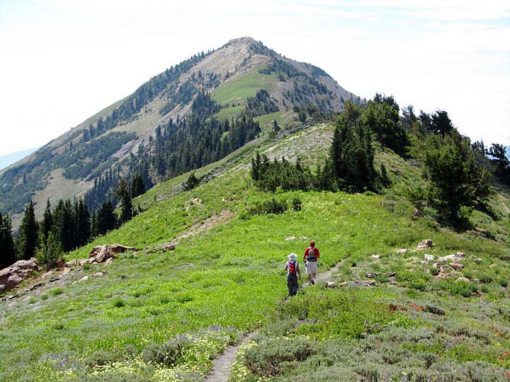
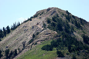
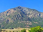
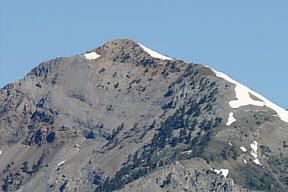
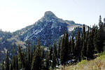
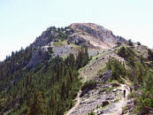
One of our favorite hikes is hiking to the top of Ben Lomond, a mountain peak located to the north of Ogden Utah. These are photos from our latest hike to Ben Lomond. Bill, Don, Judy, and I did this one on July 29th, 2010. As usual, we drove up the road from Mantua Utah to Willard Basin, then hiked up to the ridge below Willard Peak and went across the ridge to Ben Lomond. It's about 3 miles this way, and is the shortest way to reach Ben Lomond on foot, the other trails being more than 8 miles one way.
Three of us had our cameras with us, and took hundreds of photos each. I wish I could show you all the photos that we took, so many this time came out looking great. The nice sunny day and so many flowers this year, made for some fantastic pictures..
Three of us had our cameras with us, and took hundreds of photos each. I wish I could show you all the photos that we took, so many this time came out looking great. The nice sunny day and so many flowers this year, made for some fantastic pictures..
We walked about 6 miles according to the GPS, but the sign up there says it is 3½ miles one way
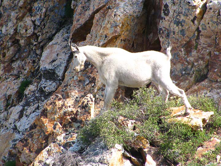
?. We took a lot of pictures of wild flowers this time, as they were more plentiful this year than any year before. Also a lot of the pictures are of us, as I have done this hike many times. And of course there are some of mountain goats.
This year I took my small pocket camera, the Canon SX210, which has 14 megapixels and 14x optical zoom. Some full zoomed shots of the goats were blurry, and I have since started using a monopod to get better telephoto shots. Even though this camera has Image Stablilization, it isn't enough at 14x. Some of my goat pictures turned out OK, I am pretty happy with the results, considering this is just a pocket camera.
This year I took my small pocket camera, the Canon SX210, which has 14 megapixels and 14x optical zoom. Some full zoomed shots of the goats were blurry, and I have since started using a monopod to get better telephoto shots. Even though this camera has Image Stablilization, it isn't enough at 14x. Some of my goat pictures turned out OK, I am pretty happy with the results, considering this is just a pocket camera.
you can view my photos by clicking on either picture here
or the 'View Photos' button
or the 'View Photos' button
If you are interested in Mountain Goats, check out
Bald Mountain, 2009 ,
Ben Lomond 2005 , Ben Lomond 2006 & Willard Pk 2008
CLICK for GPS map of our trek

For road map to Willard Basin , CLICK here
If you want to drive up to Willard Basin, I have included a couple of maps showing the way. I broke the map into two parts so that it can be printed. Take highway 91 east from Brigham City and get off at the exit for Mantua, (Man-ta-way), The road is marked in red on the map, but be advised, the road is a 4 wheel vehicle road only. After the first half it gets very rough. It takes more than an hour to travel it one way. Watch out for off road ATV's, as they travel this road a lot.
Update, This road was graded and improved some in 2009, and not quite as bad as it used to be.
Update, This road was graded and improved some in 2009, and not quite as bad as it used to be.
- 72 photos -
to look at these photos
click 'View Photos' button
to look at these photos
click 'View Photos' button
Related Photos
Hiking to Ben Lomond, and Willard Peak
Ben Lomond, 2004
Ben Lomond, 2005
Ben Lomond, 2006
Ben Lomond, 2012
Ben Lomond, 1998
Ben Lomond Falls, 05

Willard Peak, 2003
Willard Peak, 2008
My photos were taken with a small Canon Powershot, SX210, 14 Megapixel Camera which has Image Stabilazation and a lens going from wide angle to 14x optical zoom. Some of these photos were taken by Bill Joy with his Olympus E620 SLR and lens assortment. Judy took some of the photos with her Canon Digital Reble Xti SLR, and assortment of lenses.
These photos are set to lower resolution and compressed 10:1 for faster loading. You are welcome to look at or download any of the photos. If you use them on any other webpage, please give credit and refer back to me.
[an error occurred while processing this directive]
Visitors on site now (
[an error occurred while processing this directive]
)
Total visits
[an error occurred while processing this directive]
Hiking to Ben Lomond, and Willard Peak
|
Ben Lomond, 2004
|
Ben Lomond, 2005
|
Ben Lomond, 2006
|
Ben Lomond, 2012
|
|
Ben Lomond, 1998
|
Ben Lomond Falls, 05
|
Willard Peak, 2003
|
Willard Peak, 2008
|
My photos were taken with a small Canon Powershot, SX210, 14 Megapixel Camera which has Image Stabilazation and a lens going from wide angle to 14x optical zoom. Some of these photos were taken by Bill Joy with his Olympus E620 SLR and lens assortment. Judy took some of the photos with her Canon Digital Reble Xti SLR, and assortment of lenses.
These photos are set to lower resolution and compressed 10:1 for faster loading. You are welcome to look at or download any of the photos. If you use them on any other webpage, please give credit and refer back to me.
These photos are set to lower resolution and compressed 10:1 for faster loading. You are welcome to look at or download any of the photos. If you use them on any other webpage, please give credit and refer back to me.