
HIKING TO NOTCH MOUNTAIN - HIGH UINTAS
July 2000 - 24 photos
July 2000 - 24 photos
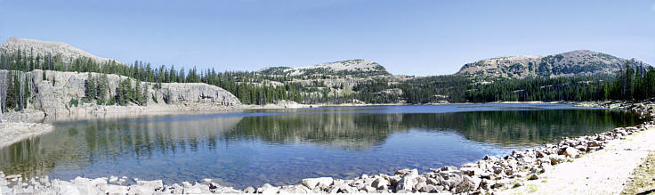
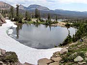
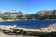
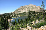
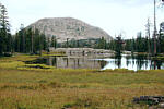
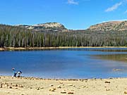
We hiked from Trial Lake to Notch Mountain, High Uinta's on July 23rd 2000. Located in north-eastern Utah, the Uinta Mountain range is designated as a Wilderness area. Traveling east of Kamas Utah towards Mirror Lake, we turned off the highway at Trial Lake and started the hike from the parking lot located above Trial Lake. From there the trail head is well marked. The trail starts out at nearly 10,000 feet altitude, but is fairly easy varying only about 400 feet until the climb up into the notch of Notch Mountain, a few hundred feet more to 10, 580 feet. This hike took us past many small alpine lakes and the larger Wall Lake. Standing in the Notch, you can see three lakes to the north and looking south you can see many lakes, including Wall Lake, Trial Lake and Washington Lake. Coming down we took the Clyde lake loop trail passing many more lakes. The hike was about six and a half miles long.
This area is called the High Uinta's becasue it's all above the 9,000 foot level, with some of the peaks exceeding 13,000 feet.
To see map of hike area, CLICK here

- 24 photos -
to look at these photos
click 'View Photos' button
to look at these photos
click 'View Photos' button
Related Photos
We have hiked Clyde Lake and Notch Mountain loop often,
so there are many related hike pages included here
Notch Mountain, 2013

Notch Mountain, 2011
Notch Mountain, 2010

Notch Mountain, 2009
Clyde Lake, 2004
Mount Watson, 2005
Notch Mountain, 2014
More Uinta Hikes

The photos shown on this and the following pages were taken with an Olympus C-2500L SLR Digital 2.5 Megapixel Camera, with 3x optical zoom. The original resolution was set at 1280 x 1024. These photos are now 625 x 500 to save computer memory. You are welcome to look at or download any of the photos. If you use them on any other webpage, please give credit and refer back to me.
[an error occurred while processing this directive]
Visitors on site now (
[an error occurred while processing this directive]
)
Total visits
[an error occurred while processing this directive]
We have hiked Clyde Lake and Notch Mountain loop often,
so there are many related hike pages included here
|
Notch Mountain, 2013
|
Notch Mountain, 2011
|
Notch Mountain, 2010
|
|
Notch Mountain, 2009
|
Clyde Lake, 2004
|
Mount Watson, 2005
|
|
Notch Mountain, 2014
|
More Uinta Hikes
|
The photos shown on this and the following pages were taken with an Olympus C-2500L SLR Digital 2.5 Megapixel Camera, with 3x optical zoom. The original resolution was set at 1280 x 1024. These photos are now 625 x 500 to save computer memory. You are welcome to look at or download any of the photos. If you use them on any other webpage, please give credit and refer back to me.