HIKING TO NOTCH PASS
August 2009 - 72 photos
August 2009 - 72 photos
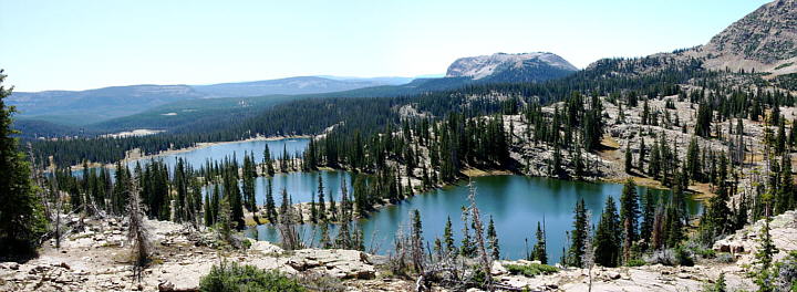
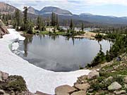
Bill Joy and I went hiking on Tuesday the 22nd of August, 2009, This area is one of the most scenic in all of Northern Utah. The area where we went is at the western end of the Uintas, just outside of the Wilderness Area. We took SR 150 out of Kamas and turned off at Trial Lake. We started our hike from the parking lot between Trial Lake and Washington Lake, (10,033 feet above sea level). We took the Notch Mountain Trail past the Lilly lakes, Wall Lake, and Hope Lake, up into the notch. Notch Pass was at 10,636 feet. From the pass we could see Lovenia Lake, and two other small lakes on the north side and many lakes to the south. Right below us to the south was a fantastic view of the Twin Lakes above Wall Lake. From the pass we followed a wide ledge to the west over to the divide that drops down into Weber Canyon above Smith Morehouse. We wanted to check out the Three Divide Lakes, John Lake, and Booker Lake. We came back along the Clyde Lake trail, past Clyde Lake, Watson Lake, and Cliff Lake. We saw 21 lakes in all, walking 6.43 miles according to my GPS unit. This wasn't a hard hike, although it did seem long at 6 hours. We only climbed a total of 603 feet. It took us longer, as we stopped to take a lot of pictures. Myself, I took 202.
I am doing something different with the hike photos for this hike. As I have hiked this trail three times in the past, and have many photos of these lakes presented on my webpages, I decided to do mostly panoramas this time. I like using them because they show the scenery more the way it looked to my eyes. Smaller photos just don't do justice to such beautiful scenery.
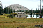
View to the north, Notch Mountain over Wall Lake
CLICK for GPS map of our hike
To get to the Trial Lake area, take SR 150 from Kamas Utah, or Evanston Wyoming, going towards Mirror Lake. A few miles south of the top of the divide, Bald Mountain Pass, the road makes a large half circle turn. In the middle of this turn is a side road leading to Trial Lake. Stay to the left at the first junction, and the right at the second. There is a parking lot at the Crystal Lake Trailhead. The Notch Mountain Trailhead is from the same parking lot.
you can view our photos by clicking on any of the pictures here
or the 'View Photos' button
View south from Notch Pass of three lakes, Wall Lake at the left and the Twin Lakes
- 72 photos -
to look at these photos
click 'View Photos' button
Related Photos
We have hiked Clyde Lake and Notch Mountain loop often,
so there are many related hike pages included here
Notch Mountain, 2013
Notch Mountain, 2011
Notch Mountain, 2010
Notch Mountain, 2000
Clyde Lake, 2004
Mount Watson, 2005
Notch Mountain, 2014
More Uinta Hikes
My photos were taken with a Canon EOS 40D, 10.1 Megapixel SLR Camera and the Canon EFs 17-85mm IS wide angle to 5x zoom lens. I carried a Canon EF 70-300mm IS Telephoto for close ups. Some of these photos were taken by Bill Joy with his Olympus E620 SLR and additional lenses.
These photos are set to lower resolution and compressed 10:1 for faster loading. You are welcome to look at or download any of the photos. If you use them on any other webpage, please give credit and refer back to me.
[an error occurred while processing this directive]
Visitors on site now (
[an error occurred while processing this directive]
)
Total visits
[an error occurred while processing this directive]
To get to the Trial Lake area, take SR 150 from Kamas Utah, or Evanston Wyoming, going towards Mirror Lake. A few miles south of the top of the divide, Bald Mountain Pass, the road makes a large half circle turn. In the middle of this turn is a side road leading to Trial Lake. Stay to the left at the first junction, and the right at the second. There is a parking lot at the Crystal Lake Trailhead. The Notch Mountain Trailhead is from the same parking lot.
or the 'View Photos' button
to look at these photos
click 'View Photos' button
Related Photos
We have hiked Clyde Lake and Notch Mountain loop often,
so there are many related hike pages included here
Notch Mountain, 2013
Notch Mountain, 2011
Notch Mountain, 2010
Notch Mountain, 2000
Clyde Lake, 2004
Mount Watson, 2005
Notch Mountain, 2014
More Uinta Hikes
My photos were taken with a Canon EOS 40D, 10.1 Megapixel SLR Camera and the Canon EFs 17-85mm IS wide angle to 5x zoom lens. I carried a Canon EF 70-300mm IS Telephoto for close ups. Some of these photos were taken by Bill Joy with his Olympus E620 SLR and additional lenses.
These photos are set to lower resolution and compressed 10:1 for faster loading. You are welcome to look at or download any of the photos. If you use them on any other webpage, please give credit and refer back to me.
[an error occurred while processing this directive]
Visitors on site now (
[an error occurred while processing this directive]
)
Total visits
[an error occurred while processing this directive]
We have hiked Clyde Lake and Notch Mountain loop often,
so there are many related hike pages included here
|
Notch Mountain, 2013
|
Notch Mountain, 2011
|
Notch Mountain, 2010
|
|
Notch Mountain, 2000
|
Clyde Lake, 2004
|
Mount Watson, 2005
|
|
Notch Mountain, 2014
|
More Uinta Hikes
|
My photos were taken with a Canon EOS 40D, 10.1 Megapixel SLR Camera and the Canon EFs 17-85mm IS wide angle to 5x zoom lens. I carried a Canon EF 70-300mm IS Telephoto for close ups. Some of these photos were taken by Bill Joy with his Olympus E620 SLR and additional lenses.
These photos are set to lower resolution and compressed 10:1 for faster loading. You are welcome to look at or download any of the photos. If you use them on any other webpage, please give credit and refer back to me.
These photos are set to lower resolution and compressed 10:1 for faster loading. You are welcome to look at or download any of the photos. If you use them on any other webpage, please give credit and refer back to me.


