
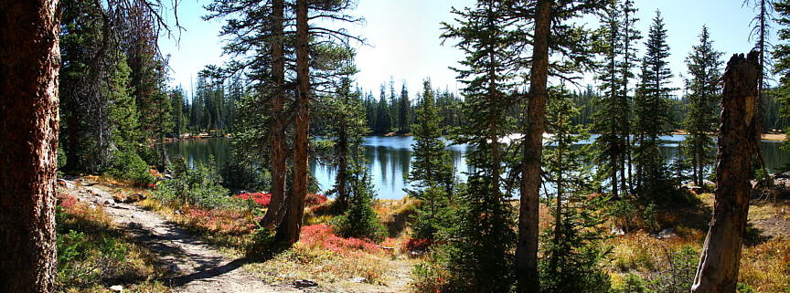
FEHR LAKE, MURDOCK BASIN
Uinta Mountains
September 2009 - 56 photos
Uinta Mountains
September 2009 - 56 photos
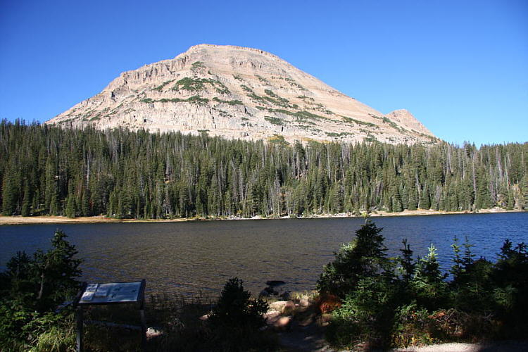
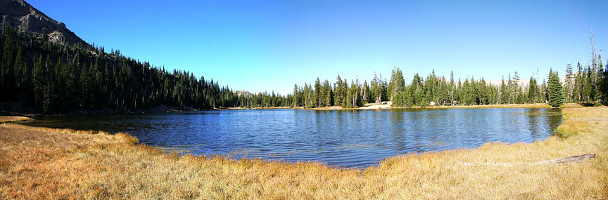
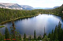
September 26, 2009, Bill Joy and I went up into the Uinta Mountains again, this time to hike down into Murdock Basin, a valley with five lakes. We took the Fehr Lake trail that starts across SR 150 from Moosehorn Lake on the east side of Bald Mountain. We found the area to be fantastic, and some of the plant life around the edge of the lakes were a bright red color, really contrasting well with the green of the pines and blue of the water. We both thought these lakes were some of the best we had visited yet, especially Marshall Lake. We liked that one best.
In checking where the name Fehr came from, I found it was a German name common to a Ferryman or Boatmen, and pronounced Feer.
In checking where the name Fehr came from, I found it was a German name common to a Ferryman or Boatmen, and pronounced Feer.
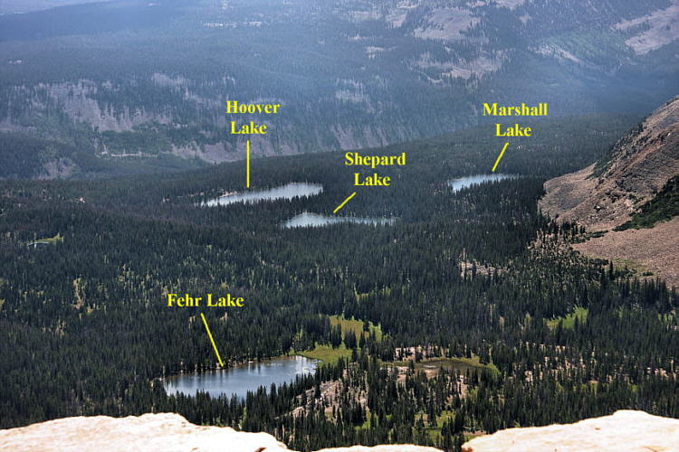
We hiked about 5 miles going to 4 of the lakes, dropping down 582 feet, and climbing back out. The trail sign declares these lakes to be reached by a very short hike, but we couldn't find a trail past Shepard Lake, the second lake on our hike. We ended up waking through the forest using the GPS compass to reach Hoover Lake and Marshall Lake. Didn't have much trouble finding the lakes, but wandered a little getting there and at Marshall Lake we walked most of the way around it to get the photos we wanted. We then cut through the forest again going back to Shepard Lake. From there we had a good trail climbing back out. There may be a trail between all of the lakes. Good luck finding it.
The canyon just beyond the lakes is were the Duchesne River begins
We had planned on visiting Maba Lake too, but went south at Hoover Lake to get better sun angles for our photos, thinking we would cross over to Maba from Shepard Lake on the way back. But when we got back to Shepard we realized that Maba was quite a ways below us and decided not to go, since it meant going down hill and back again.
We also took some photos of Moosehorn Lake and Mirror Lake. We went to Mirror Lake early in the morning before the hike, to get pictures of Bald Mountain in the morning sun. Moosehorn we visited at the end of the day. We really picked a good time of year for this hike. It was cool and very colorful.
We also took some photos of Moosehorn Lake and Mirror Lake. We went to Mirror Lake early in the morning before the hike, to get pictures of Bald Mountain in the morning sun. Moosehorn we visited at the end of the day. We really picked a good time of year for this hike. It was cool and very colorful.
CLICK for GPS map of our trek

The Fehr Lake trail starts right across the highway from Moosehorn Lake in the Uintas. Take SR 150 from Kamas Utah, or Evanston Wyoming, going towards Mirror Lake. A short way north of Bald Mountain Pass, is Moosehorn Lake on the west side. Over on the east side is a small parking lot for the Fehr Lake Trail.
you can view our photos by clicking on any of the pictures here
or the 'View Photos' button
 Moosehorn Lake late in the afternoon, looking north
- 56 photos -
to look at these photos
click 'View Photos' button
Related Photos
We also did a hike to other lakes in Murdock Basin
Echo Lake, 2010
More Uinta Hikes

My photos were taken with a Canon EOS 40D, 10.1 Megapixel SLR Camera and the Canon EFs 17-85mm IS wide angle to 5x zoom lens. I carried a Canon EF 70-300mm IS Telephoto for close ups. Some of these photos were taken by Bill Joy with his Olympus E620 SLR and additional lenses.
These photos are set to lower resolution and compressed 10:1 for faster loading. You are welcome to look at or download any of the photos. If you use them on any other webpage, please give credit and refer back to me.
[an error occurred while processing this directive]
Visitors on site now (
[an error occurred while processing this directive]
)
Total visits
[an error occurred while processing this directive]
The Fehr Lake trail starts right across the highway from Moosehorn Lake in the Uintas. Take SR 150 from Kamas Utah, or Evanston Wyoming, going towards Mirror Lake. A short way north of Bald Mountain Pass, is Moosehorn Lake on the west side. Over on the east side is a small parking lot for the Fehr Lake Trail.
or the 'View Photos' button
to look at these photos
click 'View Photos' button
Related Photos
We also did a hike to other lakes in Murdock Basin
Echo Lake, 2010
More Uinta Hikes
My photos were taken with a Canon EOS 40D, 10.1 Megapixel SLR Camera and the Canon EFs 17-85mm IS wide angle to 5x zoom lens. I carried a Canon EF 70-300mm IS Telephoto for close ups. Some of these photos were taken by Bill Joy with his Olympus E620 SLR and additional lenses.
These photos are set to lower resolution and compressed 10:1 for faster loading. You are welcome to look at or download any of the photos. If you use them on any other webpage, please give credit and refer back to me.
[an error occurred while processing this directive]
Visitors on site now (
[an error occurred while processing this directive]
)
Total visits
[an error occurred while processing this directive]
We also did a hike to other lakes in Murdock Basin
|
Echo Lake, 2010
|
More Uinta Hikes
|
My photos were taken with a Canon EOS 40D, 10.1 Megapixel SLR Camera and the Canon EFs 17-85mm IS wide angle to 5x zoom lens. I carried a Canon EF 70-300mm IS Telephoto for close ups. Some of these photos were taken by Bill Joy with his Olympus E620 SLR and additional lenses.
These photos are set to lower resolution and compressed 10:1 for faster loading. You are welcome to look at or download any of the photos. If you use them on any other webpage, please give credit and refer back to me.
These photos are set to lower resolution and compressed 10:1 for faster loading. You are welcome to look at or download any of the photos. If you use them on any other webpage, please give credit and refer back to me.