
Bicycle Ride along Provo River Parkway
August 2009 - 42 photos
August 2009 - 42 photos
(Last updated August 2010)
I received an email from someone visiting my website, telling me about a ride that might interest me. It was the Provo River Pathway in Utah County that is 16 miles long. On a Friday morning in August, I decided to drive down to Provo. The email had mentioned that the trail started at Provo Airport, but I didn't know where that was, so decided to go looking for the trail in Provo Canyon. That was were the other end began. I found the trail head at Vivian Park, about a half mile above Bridal Veil Falls. I started riding at 9:30 going down the canyon. At 4.75 miles I came to a large parking lot marked Mount Timpanogos Park. This was just inside the mouth of the canyon and I could see that it was still down hill, so I decided to make this ride in steps so that I wouldn't have to ride the steepest part at the end. I rode my bike back up the canyon finding it not quite as hard as expected, but still a good workout.
I drove my car down to Timpanogos Park and started riding again, on down into town. The Trail left the river and turned south running along University Avenue for quite a ways, finally turning west down 2250 North in Provo. (Note: the section along 2250 North is along city sidewalks). Again, I decided that it was too much up hill to leave for the end, so went back to the car. This section was about 5.25 miles long, so now I had ridden 20 miles total.
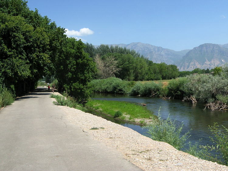
I got the car and drove through Provo trying to find the river. I found that you can go down Center Street in Provo to where the Utah Lake Campgrounds are, where the road curves around to the right like a big U or horseshoe and right in the middle of that turn on the right side is the trailhead. I parked there and rode my bike back up the trail to where I had stopped on 2250 North. This section of 6 miles was along the river and through some city parks. I should mention that there are many street underpasses along this trail, and most are very narrow. There isn't much room for a bike rider and a pedestrian to pass each other. This ride took me four and a half hours, and the odometer showed a total of 32 miles for the ride.
Every time I go down to ride the Provo trail now, I start from the west end at Utah Lake, so that coming back it's all down hill. If driving the I-15 Freeway, you can get off on Provo's Center Street and go west to Utah Lake.
I drove my car down to Timpanogos Park and started riding again, on down into town. The Trail left the river and turned south running along University Avenue for quite a ways, finally turning west down 2250 North in Provo. (Note: the section along 2250 North is along city sidewalks). Again, I decided that it was too much up hill to leave for the end, so went back to the car. This section was about 5.25 miles long, so now I had ridden 20 miles total.
I got the car and drove through Provo trying to find the river. I found that you can go down Center Street in Provo to where the Utah Lake Campgrounds are, where the road curves around to the right like a big U or horseshoe and right in the middle of that turn on the right side is the trailhead. I parked there and rode my bike back up the trail to where I had stopped on 2250 North. This section of 6 miles was along the river and through some city parks. I should mention that there are many street underpasses along this trail, and most are very narrow. There isn't much room for a bike rider and a pedestrian to pass each other. This ride took me four and a half hours, and the odometer showed a total of 32 miles for the ride.
Every time I go down to ride the Provo trail now, I start from the west end at Utah Lake, so that coming back it's all down hill. If driving the I-15 Freeway, you can get off on Provo's Center Street and go west to Utah Lake.
CLICK for map of Provo River Trail
- 42 photos -
to look at these photos
click 'View Photos' button
to look at these photos
click 'View Photos' button
I used a Canon Powershot SD700 IS Digital Elph, 6 megapixel, with 4x optical and 4x digital zoom. These photos are set to lower resolution and compressed 10:1 for faster loading. You are welcome to look at or download any of the photos. If you use them on any other webpage, please give credit and refer back to me.